I Smell More Global Warming … 2014 Ushered in With Record Low Temperatures and Massive Snow Storm … Get Ready for ‘Hercules’
A funny thing happened on the way to global warming, abnormally cold temperatures break out …
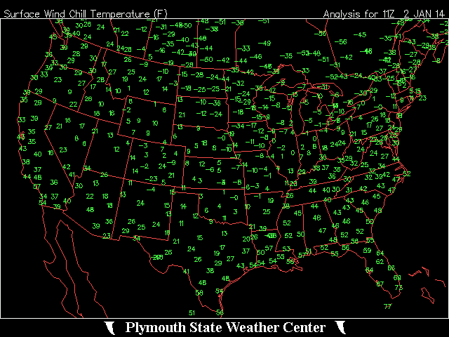
2014 has been ushered in with abnormally cold temperatures in the United States. Across the US record low temperatures are being experienced that would make even Al Gore maybe question is own BS. And it is not just America, our friends in the ‘Great White North’ are experiencing incredible low temperatures as well. CNC News is reporting that Manitoba, Canada the Manitoba Museum is reporting Winnipeg’s temperatures on Tuesday were actually as cold as the surface of Mars at -29 C (-20 F) at 3 pm.
Pic -Plymouth State Weather Center
The recent surge of arctic air in Wisconsin has led to record-breaking low temperatures in places like Owen, a Clark County town that hit minus 31 degrees this week.
A La Crosse Tribune report says records were tied or broken in about half a dozen cities in the region.
The La Crosse airport hit a low of minus 17 degrees. That tied a record set in 1976. Friendship also tied a record with temperatures of minus 22.
Owen got down to minus 31 degrees, two degrees colder than the previous record set in 1963.
Zack Taylor is a meteorologist with the National Weather service. He says the cold is part of an arctic front. He says temperatures should warm up a tad later this week, but another arctic front could arrive by the weekend.
Cold, blustery conditions will push across the northern Plains and the upper Midwest on Tuesday as an arctic air mass sweeps across the region.
WCCO meteorologists are forecasting the coldest New Year’s Eve ever in International Falls, Minn. The forecast is a low of -39° (the old record is -38°).
Temperatures are expected to be 20 to 30 degrees below normal in North Dakota and Minnesota, while a line of snow showers will move across the area. The heaviest snow is expected to develop in the Dakotas, southern Minnesota, northeastern Iowa, southern Wisconsin and northern Illinois.
But of course the global warming crowd is still at it trying to tell you that dinosaurs are coming back because of global warming.
Get ready for HERCULES … Good grief, why do we name snow storms, I mean really?
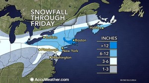
The storm, predicted to affect the USA from the upper Midwest to the East Coast, is expected to bring the heaviest snow across southern New England on Thursday and early Friday.
“Over a foot of snow will fall in localized areas of Massachusetts, Rhode Island and Connecticut and the cities of Hartford, Conn., Providence, R.I., and Boston,” predicted AccuWeather meteorologist Alex Sosnowski. Lesser amounts, in the 6- to 12-inch range, are likely in northeastern Pennsylvania, in New Jersey and in southeastern New York state.
A note to the folks in New York and Boston as you are reading those global warming stories, hunker down and get ready for “snowmageddon” as AccuWeather is reporting that a major snowstorm will reach from across part of the Midwest to the central Appalachians and New England Thursday into Friday and a blizzard will evolve from the storm in parts of the Northeast.
The storm will affect more than 70 million people in the Midwest and the Northeast combined and could have a major negative impact on travel for people returning from holiday destinations, heading back to school or resuming business activities.
It will be far from the worst storm to ever hit the area, but people should be prepared for flight delays and cancellations because of direct and indirect impacts from the far-reaching storm. Some roads may even close for a time.
If you liked this post, you may also like these:
Comments
Leave a Reply

 RSS
RSS


